Goal
The purpose of this project is to introduce and work with
geoprocessing tools and scripts within ArcGIS such as union, intersect,
overlay, buffer, and dissolve.
Background
Students were to use bear sighting data points within a given
study area in Marquette County, MI. Students were to determine areas
suitable for bear habitat that fall in the following criteria:
-The landcover type must be in one of the three most visited bear
habitats: Mixed Forest Lands, Forested Wetlands, or Evergreen Forest Lands.
-The area must be within 500 meters of a stream.
-The area must be within areas that the Michigan DNR has already
designated to manage (area of an area).
-Lastly, the area must be 5km from land uses that are used as
urban spaces.
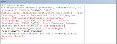
*A second part of this lab was to provide a basic introduction to
python using ArcGIS Python window.
Methods
There were 8 objectives to this lab and students first needed to
convert excel data into a feature class that is interactive in ArcMap. This was
done by first downloading the data and adding it as an ‘XY event theme,’ and
then exporting the shapefile data into a new feature class. The result is a new
feature class of bear sighting data points that is able to be seen in ArcMap.
Next, students had to determine which criteria should be used in
determining an appropriate site for bear habitats. The first criterion was to
use the intersect tool for the bear_locations and landcover feature classes and
summarizing the results. This determined conclusions about the types of
environmental spaces bears visit frequently. The environmental spaces
were: Mixed Forest Lands, Forested Wetlands, or Evergreen Forest Lands. The
next criterion determined the number of bear habitats to be located near 500m
of streams using the buffer tool. The spatial join resulted in a new feature
class “Bear_Streams,” and students used the statistic tool to calculate the
mean of sightings within the designated area. Then, frequented bear habitats
was intersected with "dnr_mgmt." The intersection of these two
features resulted in the total area for suitable bear habitats. By clipping
this area to DNR_management areas, a new feature that the DNR may manage was
created. Finally, a buffer was created around the urban feature and erased from
the DNR management layer to create a final feature that represents all land
that the DNR should manage for bears.
Now having established the criteria necessary for bear habitat,
students were to generate a cartographically pleasing data flow model of the
respective workflows, as well as a cartographically pleasing map of our
results.
Results
I generated my data flow model by dragging the results of my tool uses to the model flow that ArcGIS gives. I then manually arranged them by objective.
Map: Most bears frequented within 500m of streams in the South-Central, North-Central, and Southwest part of the study area. They tended not to frequent in the Southeastern part of the study area due to urban land-use.
Map: Most bears frequented within 500m of streams in the South-Central, North-Central, and Southwest part of the study area. They tended not to frequent in the Southeastern part of the study area due to urban land-use.
The Michigan Geographic Data Library


No comments:
Post a Comment